|
|

|

Grid lines
Grid lines can be toggled from menu View / Gadgets and via the Solar system pane ( View / Gadgets / Solar system)
Latitude and Longitude grid lines
Latitude and Longitude grid lines are drawn with progressive density depending on the observer position.
The international date line is also shown.

Equator, Tropics and Arctic lines

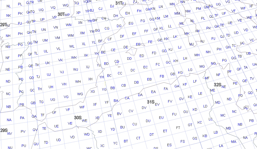
MGRS grid
The Military Grid Reference System Grid is also displayed with progressive density depending on the zooming level, first with UTM zones and then with 100000 meter square identifications.

Multisatellite Swath Planner - © Taitus Software Italia srl All rights reserved- info: support@taitus.it